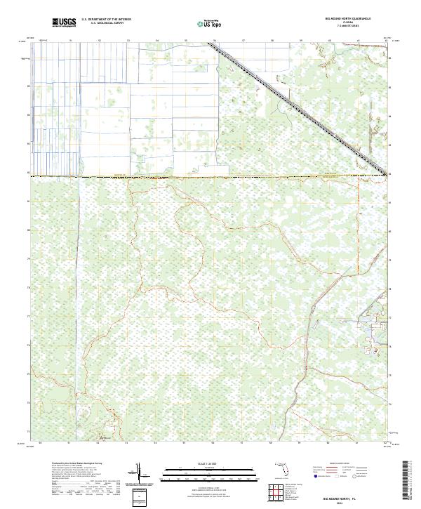
2024 Map of Big Mound North
USGS Topo · Published 2024About this map
Big Mound stands as a distinct landmark in this wetland-rich portion of the Florida interior, situated along the boundary where Martin County meets Palm Beach County. The landscape is defined by vast conservation tracts, primarily managed through the J W Corbett Wildlife Management Area and the Dupuis Reserve. Historically, this area represents a transition between the northern drainage of the Everglades and the agricultural lands to the west. While much of the terrain is characterized by intricate water networks and marshy ground, the map highlights the critical transportation arteries and trail systems that provide access to this remote region, including the diagonal path of SW Warfield Blvd and the utility-focused N Grade Rd.
Find a feature on this map
15 named features on this map. Tap any name to fly to it.
Don’t see what you’re looking for? This feature index may not catch every label — zoom into the map to look around manually.
Map Details
Editions of this 2024 Big Mound North Map
This is the sole edition of this map. No revisions or reprints were ever made.
Other maps of this area

1953 · Okeechobee 4 SE
USGS Topo · 1:24,000

1953 · Indian Town SE
USGS Topo · 1:24,000

1953 · Indian Town
USGS Topo · 1:24,000

1956 · West Palm Beach
USGS Topo · 1:250,000

1956 · Fort Pierce
USGS Topo · 1:250,000

1957 · West Palm Beach
USGS Topo · 1:250,000

1958 · Fort Pierce
USGS Topo · 1:250,000

1958 · West Palm Beach
USGS Topo · 1:250,000

1959 · Fort Pierce
USGS Topo · 1:250,000

1970 · West Palm Beach 2 SW
USGS Topo · 1:24,000