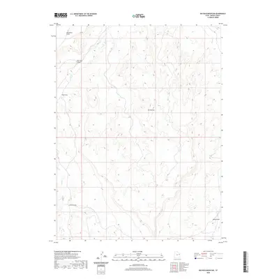
2020 Map of Big Pack Mountain
USGS Topo · Published 2020About this map
Big Pack Mtn rises above a highly dissected landscape of the Uinta Basin, where deep drainages have carved intricate patterns into the plateau. The terrain is defined by a series of prominent draws including Alger Draw and Johnson Draw, which channel seasonal water toward the lower elevations. To the north, the broad expanse of Wild Horse Bench provides a distinct topographic contrast to the narrow, winding corridors of Peter Post Canyon. This 2020 survey reveals the complex hydrology of the region, anchored by the perennial courses of Hill Cr and Willow Cr. The map's detail is particularly valuable for understanding how the local relief, specifically the sharp drops into Agency Draw, dictates the limited access across this high-desert environment.
Find a feature on this map
8 named features on this map. Tap any name to fly to it.
Don’t see what you’re looking for? This feature index may not catch every label — zoom into the map to look around manually.
Map Details
Editions of this 2020 Big Pack Mountain Map
This is the sole edition of this map. No revisions or reprints were ever made.
Other maps of this area

1885 · East Tavaputs
USGS Topo · 1:250,000

1953 · Nutters Hole
USGS Topo · 1:62,500

1953 · Firewater Canyon
USGS Topo · 1:62,500

1956 · Grand Junction
USGS Topo · 1:250,000

1959 · Grand Junction
USGS Topo · 1:250,000

1960 · Grand Junction
USGS Topo · 1:250,000

1962 · Grand Junction
USGS Topo · 1:250,000

1964 · Grand Junction
USGS Topo · 1:250,000

1965 · Grand Junction
USGS Topo · 1:250,000
1966 · Agency Draw NE
USGS Topo · 1:24,000