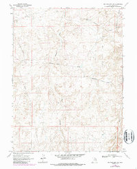
1968 Map of Big Pack Mtn. NE
USGS Topo · Published 1987About this map
The Bitter Creek Gas Field dominates this eastern Utah landscape in Uintah County, illustrating the mid-century industrial expansion into the High Desert. The terrain is defined by a dense network of arid drainages, most notably Cottonwood Wash and Sand Wash, which carve through the high plateaus. This 1968 survey details the infrastructure of energy extraction, showing a complex system of an Aboveground Pipeline and buried Pipeline routes connecting various Gas Wells and a Pumping Station. These industrial features are accessed by a network of unimproved roads and a Jeep Trail, providing a clear look at how the region was navigated before more modern infrastructure was established. For researchers and historians, the map's precise notation of a Drill Hole and specific section lines offers a primary record of land use and mineral exploration during a period of significant growth in the Uintah Basin.
Find a feature on this map
13 named features on this map. Tap any name to fly to it.
Don’t see what you’re looking for? This feature index may not catch every label — zoom into the map to look around manually.
Map Details
Editions of this 1968 Big Pack Mtn. NE Map
2 editions found
Other maps of this area

1885 · East Tavaputs
USGS Topo · 1:250,000

1885 · Ashley
USGS Topo · 1:250,000

1907 · Jensen
USGS Topo · 1:125,000

1910 · Jensen
USGS Topo · 1:125,000

1917 · Vernal
USGS Topo · 1:125,000

1954 · Vernal
USGS Topo · 1:250,000

1956 · Grand Junction
USGS Topo · 1:250,000

1958 · Vernal
USGS Topo · 1:250,000

1959 · Grand Junction
USGS Topo · 1:250,000

1960 · Vernal
USGS Topo · 1:250,000