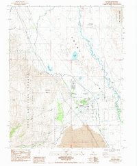
1984 Map of Big Pine
USGS Topo · Published 1984About this map
The Big Pine settlement and the Big Pine Indian Res serve as the central anchors of this Inyo County landscape in the early 1980s. Located at the foot of the eastern Sierra, the area demonstrates a complex infrastructure of water management and scientific pursuit, evidenced by the Owens Valley Radio Observatory Radio Telescopes and various Sewage Ponds and canals near the Owens River. Local institutional history is visible through the High Sch, the County Sanatorium, and the community Cem. Outside the main town, the terrain transitions into the Inyo National Forest, marked by Prospect sites and Quarries that point to the region's extractive activities. Water features like Klondike Lake and Warren Lake contrast with the arid valley floor, while the small settlement of Zurich sits to the east, connected by the local road network including Reynolds Road.
Find a feature on this map
30 named features on this map. Tap any name to fly to it.
Don’t see what you’re looking for? This feature index may not catch every label — zoom into the map to look around manually.
Map Details
Editions of this 1984 Big Pine Map
2 editions found
Other maps of this area

1913 · Bishop
USGS Topo · 1:125,000

1947 · Mariposa
USGS Topo · 1:250,000

1948 · Mariposa
USGS Topo · 1:250,000

1949 · Bishop
USGS Topo · 1:62,500

1950 · Big Pine
USGS Topo · 1:62,500

1951 · Bishop
USGS Topo · 1:62,500

1951 · Blanco Mountain
USGS Topo · 1:62,500

1951 · Waucoba Mtn.
USGS Topo · 1:62,500

1957 · Mariposa
USGS Topo · 1:250,000
1958 · Waucoba Mtn
USGS Topo · 1:62,500