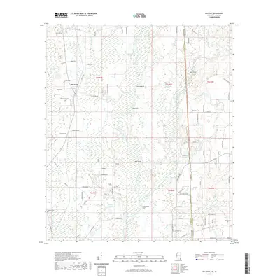
2020 Map of Big Point
USGS Topo · Published 2020About this map
The Escatawpa River snakes through a complex wetland system along the Mississippi and Alabama border, defining the low-lying character of this region. The landscape is marked by numerous bluff formations including Cowards Bluff, Sikes Bluff, Miles Bluff, and Rubenhouse Bluff that overlook the river's winding course. This 2020 survey illustrates how the environment is dominated by expansive swamp systems such as Black Creek Swamp, Island Swamp, and Red Oak Swamp. The settlement of Big Point sits on the western edge of these wetlands, surrounded by a network of family-named roads like Rayford Shumock Rd and Horace Shumock Rd. Local history is preserved in scattered burial grounds including Big Point Cem and Tates Cem, which are tucked between the various lakes and creeks that drain toward the Gulf.
Find a feature on this map
109 named features on this map. Tap any name to fly to it.
Don’t see what you’re looking for? This feature index may not catch every label — zoom into the map to look around manually.
Map Details
Editions of this 2020 Big Point Map
This is the sole edition of this map. No revisions or reprints were ever made.
Other maps of this area

1921 · Grand Bay
USGS Topo · 1:62,500

1941 · Hurley
USGS Topo · 1:62,500

1941 · Vancleave
USGS Topo · 1:62,500

1943 · Pascagoula
USGS Topo · 1:62,500

1943 · Grand Bay
USGS Topo · 1:62,500

1943 · Hurley
USGS Topo · 1:62,500

1943 · Vancleave
USGS Topo · 1:62,500

1944 · Vancleave
USGS Topo · 1:62,500

1953 · Mobile
USGS Topo · 1:250,000

1955 · Pascagoula
USGS Topo · 1:62,500