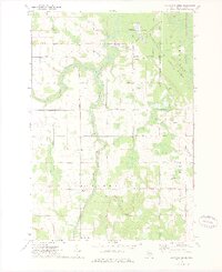
1972 Map of Big Ravine Creek
USGS Topo · Published 1975About this map
The confluence of the South Branch Thunder Bay River and the Thunder Bay River anchors this 1970s landscape within the townships of Wilson and Ossineke. The terrain is characterized by a dense network of watercourses, including Wolf Creek and Big Ravine Creek, cutting through a mosaic of woodlots and open fields. Sparse rural settlement is clustered along gravel and dirt routes such as Beaver Lake Road and Nicholson Hill Road.
Find a feature on this map
32 named features on this map. Tap any name to fly to it.
Don’t see what you’re looking for? This feature index may not catch every label — zoom into the map to look around manually.
Map Details
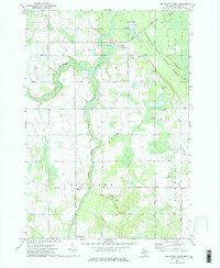
Editions of this 1972 Big Ravine Creek Map
2 editions found
Other maps of this area

1954 · Tawas City
USGS Topo · 1:250,000

1954 · Alpena
USGS Topo · 1:250,000

1957 · Alpena
USGS Topo · 1:250,000

1958 · Alpena
USGS Topo · 1:250,000

1958 · Tawas City
USGS Topo · 1:250,000

1969 · Alpena
USGS Topo · 1:250,000

1971 · Lake Winyah
USGS Topo · 1:24,000

1971 · Alpena
USGS Topo · 1:24,000

1971 · Spruce
USGS Topo · 1:24,000

1971 · Lachine
USGS Topo · 1:24,000