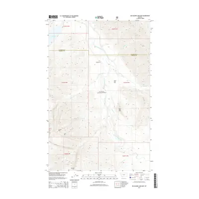
2014 Map of Big Salmon Lake East
USGS Topo · Published 2014About this map
The Flathead National Forest defines this mountain landscape, where the South Fork Flathead River and the White River converge in a complex system of alpine drainages. The terrain is anchored by high summits such as Scarface Peak, Spire Mtn, and Bartlett Mtn, which overlook a network of tributary creeks including Scarface Cr and Hammer Cr. Near the eastern edge of Big Salmon Lake, the topography transitions into the level ground of Murphy Flat and the protected environs of White River Park. This 2014 survey documents the wilderness character of the Flathead and Powell County line, illustrating how the glacial geography dictates the path of the river through the White River Butte area. The map provides a precise record of the hydrography within this protected region, including smaller flows like Lamoose Cr and Woodfir Cr.
Find a feature on this map
27 named features on this map. Tap any name to fly to it.
Don’t see what you’re looking for? This feature index may not catch every label — zoom into the map to look around manually.
Map Details
Editions of this 2014 Big Salmon Lake East Map
This is the sole edition of this map. No revisions or reprints were ever made.
Other maps of this area

1902 · Ovando
USGS Topo · 1:125,000

1905 · Ovando
USGS Topo · 1:125,000

1936 · Silvertip
USGS Topo · 1:96,000

1942 · Silvertip
USGS Topo · 1:125,000

1955 · Choteau
USGS Topo · 1:250,000

1957 · Choteau
USGS Topo · 1:250,000

1958 · Choteau
USGS Topo · 1:250,000

1962 · Choteau
USGS Topo · 1:250,000

1970 · Big Salmon Lake East
USGS Topo · 1:24,000
1970 · Pilot Peak
USGS Topo · 1:24,000