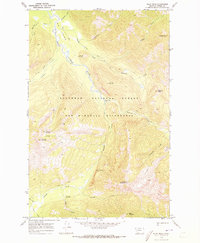
1970 Map of Pilot Peak
USGS Topo · Published 1973About this map
The South Fork Flathead River carves a deep valley through this interior section of the Flathead National Forest, representing the landscape of the Bob Marshall Wilderness just as it was formally protected. High-elevation peaks like Pilot Peak and Scintilla Mtn dominate the terrain, connected only by a network of historic routes including the Gordon Creek Trail and Hahn Creek Trail. The map documents early administrative outposts and crossings essential for forest management, such as the Hahn Creek Guard Sta and the Youngs Creek Ford. Distinctive geological features like the Hole-in-the-Wall Cave and the summit of Jumbo Lookout Mountain offer specific points of interest for backcountry researchers and hikers interested in the era before modern satellite mapping redefined these remote contours.
Find a feature on this map
33 named features on this map. Tap any name to fly to it.
Don’t see what you’re looking for? This feature index may not catch every label — zoom into the map to look around manually.
Map Details
Editions of this 1970 Pilot Peak Map
2 editions found
Other maps of this area

1902 · Ovando
USGS Topo · 1:125,000

1905 · Ovando
USGS Topo · 1:125,000

1936 · Silvertip
USGS Topo · 1:96,000

1942 · Silvertip
USGS Topo · 1:125,000

1955 · Choteau
USGS Topo · 1:250,000

1957 · Choteau
USGS Topo · 1:250,000

1958 · Choteau
USGS Topo · 1:250,000

1962 · Choteau
USGS Topo · 1:250,000
1970 · Crimson Peak
USGS Topo · 1:24,000
1970 · Danaher Mountain
USGS Topo · 1:24,000