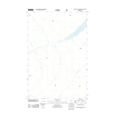
2011 Map of Big Salmon Lake West
USGS Topo · Published 2011About this map
Big Salmon Lake dominates the upper eastern corner of this Missoula County landscape, serving as the headwater source for the westward-flowing Big Salmon Creek. This high-elevation drainage system is defined by a series of prominent summits and observation points, including Patrol Point and Gyp Mountain to the south. The creek's descent through the valley is marked by Barrier Falls, a significant hydrological feature situated between Sappho Creek and Spud Creek.
Find a feature on this map
21 named features on this map. Tap any name to fly to it.
Don’t see what you’re looking for? This feature index may not catch every label — zoom into the map to look around manually.
Map Details
Editions of this 2011 Big Salmon Lake West Map
This is the sole edition of this map. No revisions or reprints were ever made.
Other maps of this area

1902 · Ovando
USGS Topo · 1:125,000

1905 · Ovando
USGS Topo · 1:125,000

1921 · Elbow Lake
USGS Topo · 1:125,000

1936 · Silvertip
USGS Topo · 1:96,000

1942 · Silvertip
USGS Topo · 1:125,000

1955 · Choteau
USGS Topo · 1:250,000

1957 · Choteau
USGS Topo · 1:250,000

1958 · Choteau
USGS Topo · 1:250,000

1962 · Choteau
USGS Topo · 1:250,000

1965 · Sunburst Lake
USGS Topo · 1:24,000