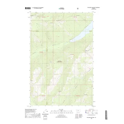
2020 Map of Big Salmon Lake West
USGS Topo · Published 2020About this map
Flathead National Forest encompasses this high-elevation mountain terrain at the junction of Flathead, Missoula, and Powell Counties. The landscape is defined by the significant basin of Big Salmon Lake, which is fed and drained by the branching network of Big Salmon Creek and Big Salmon Cr. In this contemporary era, the map traces the intricate drainage patterns of alpine water bodies including Lamoose Cr, Charlotte Cr, and Sapphire Cr. Notable vertical landmarks such as Gyp Mtn, Flame Peak, and Patrol Point provide orientation for those navigating this protected wilderness. The presence of Barrier Falls on the western edge of the quadrangle highlights the steep gradients found throughout this part of the Rockies, where named peaks like Charlotte Peak and Garnet Peak rise above the complex creek systems.
Find a feature on this map
42 named features on this map. Tap any name to fly to it.
Don’t see what you’re looking for? This feature index may not catch every label — zoom into the map to look around manually.
Map Details
Editions of this 2020 Big Salmon Lake West Map
This is the sole edition of this map. No revisions or reprints were ever made.
Other maps of this area

1902 · Ovando
USGS Topo · 1:125,000

1905 · Ovando
USGS Topo · 1:125,000

1921 · Elbow Lake
USGS Topo · 1:125,000

1936 · Silvertip
USGS Topo · 1:96,000

1942 · Silvertip
USGS Topo · 1:125,000

1955 · Choteau
USGS Topo · 1:250,000

1957 · Choteau
USGS Topo · 1:250,000

1958 · Choteau
USGS Topo · 1:250,000

1962 · Choteau
USGS Topo · 1:250,000

1965 · Sunburst Lake
USGS Topo · 1:24,000