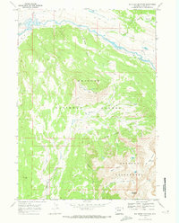
1968 Map of Big Sheep Mountain
USGS Topo · Published 1973About this map
The Green River flows through the northern reaches of this Wyoming high-country landscape, where the Bridger National Forest meets the protected expanse of the Bridger Wilderness. The 1968 survey details a rugged terrain defined by significant peaks like Big Sheep Mountain and Battleship Mountain, alongside the smaller Little Sheep Mountain. Movement through this wilderness is traced by the Highline Trail and several unpaved paths designated as Jeep Trail, reflecting the area's use for recreation and resource management during the mid-20th century. High-altitude water bodies including Brook Lake and Mud Lake sit among the drainage basins of Moose Creek and Crow Creek, while the Roaring Fork Basin occupies the northeast corner. This map provides a clear look at the Wilderness Boundary and the natural landmarks that have guided backcountry travelers for generations, from Gypsum Park to the prominent Red Hill.
Find a feature on this map
22 named features on this map. Tap any name to fly to it.
Don’t see what you’re looking for? This feature index may not catch every label — zoom into the map to look around manually.
Map Details
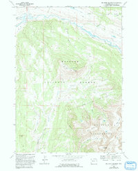
Editions of this 1968 Big Sheep Mountain Map
2 editions found
Other maps of this area

1907 · Gros Ventre
USGS Topo · 1:125,000

1909 · Fremont Peak
USGS Topo · 1:125,000

1910 · Gros Ventre
USGS Topo · 1:125,000

1955 · Driggs
USGS Topo · 1:250,000

1955 · Thermopolis
USGS Topo · 1:250,000

1958 · Driggs
USGS Topo · 1:250,000

1958 · Thermopolis
USGS Topo · 1:250,000

1962 · Thermopolis
USGS Topo · 1:250,000

1962 · Driggs
USGS Topo · 1:250,000
1966 · Dodge Butte
USGS Topo · 1:24,000