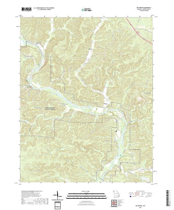
2021 Map of Big Spring
USGS Topo · Published 2021About this map
The Current River carves a winding path through this portion of Carter County, shaping a landscape defined by deep valleys and narrow ridges. Central to the area is the settlement of Chilton, situated near the riverbanks where Chilton Creek joins the main flow. The terrain is marked by numerous family and community landmarks, including the Chilton Cemetery, Kelleys Cemetery, and the Carter Family Cemetery, which provide significant points of interest for genealogical research.
Find a feature on this map
56 named features on this map. Tap any name to fly to it.
Don’t see what you’re looking for? This feature index may not catch every label — zoom into the map to look around manually.
Map Details
Editions of this 2021 Big Spring Map
This is the sole edition of this map. No revisions or reprints were ever made.
Other maps of this area

1928 · Cardareva
USGS Topo · 1:62,500

1943 · Ellington
USGS Topo · 1:62,500

1944 · Van Buren
USGS Topo · 1:62,500

1944 · Grandin
USGS Topo · 1:62,500

1945 · Ellington
USGS Topo · 1:62,500

1946 · Grandin
USGS Topo · 1:62,500

1946 · Van Buren
USGS Topo · 1:62,500

1949 · Rolla
USGS Topo · 1:250,000

1949 · Cardareva
USGS Topo · 1:62,500

1953 · Rolla
USGS Topo · 1:250,000