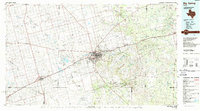
1954 Map of Big Spring
USGS Topo · Published 1965About this map
Big Spring and the surrounding West Texas plains are defined by the industrial and transport arteries of the mid-1950s, particularly the Texas and Pacific RR corridor. This rail line links several major regional hubs, including Colorado City, Sweetwater, and Stanton, reflecting the era's reliance on rail for moving petroleum and agricultural products. To the north, Snyder and Lamesa anchor their respective counties, while the Colorado River and the newly established Lake J B Thomas provide critical water infrastructure in a landscape dotted with intermittent draws like Mustang Creek and Sulphur Draw. Grounded in the geological character of the region, the map highlights distinct topographic features such as Signal Mountain, Rattlesnake Gap, and the Flat Top Mountains. For the local historian or genealogist, the map preserves the locations of smaller communities like Vealmoor, Forsan, and Tarzan, alongside localized landmarks like Boyds Chapel and numerous pumping stations that signal the region's burgeoning energy sector.
Find a feature on this map
153 named features on this map. Tap any name to fly to it.
Don’t see what you’re looking for? This feature index may not catch every label — zoom into the map to look around manually.
Map Details
Editions of this 1954 Big Spring Map
4 editions found
Historical Maps of Big Spring Through Time
3 maps found