1986 Map of Big Spring
USGS Topo · Published 1989About this map
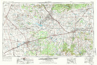
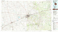
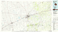
Big Spring serves as the focal point of this 1980s landscape, situated at the convergence of the Missouri Pacific railroad and a network of desert draws. The terrain is defined by the high, flat mesas of the Iatan Flats and prominent landmarks like Signal Peak and Wildhorse Mountain, which contrast with the drainage basins of Sulphur Springs Draw and Mustang Draw. This era shows the region's deep ties to aviation and energy, noted by the presence of the Big Spring Municipal Airport and the sprawling Spraberry Trend road system to the southwest.
Find a feature on this map
57 named features on this map. Tap any name to fly to it.
Don’t see what you’re looking for? This feature index may not catch every label — zoom into the map to look around manually.
Map Details
Editions of this 1986 Big Spring Map
2 editions found
Historical Maps of Big Spring Through Time
3 maps found