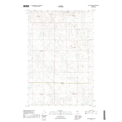
2019 Map of Big Thunder Peak
USGS Topo · Published 2019About this map
Sugar Hills and Big Thunder Peak dominate this northern landscape on the border of Itasca and Aitkin counties. The area is defined by a dense network of wetlands and water bodies, most notably the Little Hill River Wildlife Impoundment and the winding course of the Little Hill River. Local roads and trails like Smith Creek Trl, Walker Rd, and Hill Rd provide access through the timbered terrain, connecting scattered lakes such as Holy Water Lake and Muskey Lake. This map captures a classic Minnesota northwoods environment where the drainage of Morrison Brook and Smith Cr shapes the low-lying basins between the glacial hills. The township lines for t54n r27w and t53n r26w provide the cadastral framework for this largely undeveloped territory.
Find a feature on this map
25 named features on this map. Tap any name to fly to it.
Don’t see what you’re looking for? This feature index may not catch every label — zoom into the map to look around manually.
Map Details
Editions of this 2019 Big Thunder Peak Map
This is the sole edition of this map. No revisions or reprints were ever made.
Other maps of this area

1953 · Siseebakwet Lake
USGS Topo · 1:24,000

1953 · Grand Rapids
USGS Topo · 1:24,000

1953 · Duluth
USGS Topo · 1:250,000

1954 · Hibbing
USGS Topo · 1:250,000

1957 · Hibbing
USGS Topo · 1:250,000

1958 · Hibbing
USGS Topo · 1:250,000

1958 · Duluth
USGS Topo · 1:250,000

1964 · Hibbing
USGS Topo · 1:250,000

1970 · Big Thunder Peak
USGS Topo · 1:24,000

1970 · Shovel Lake
USGS Topo · 1:24,000