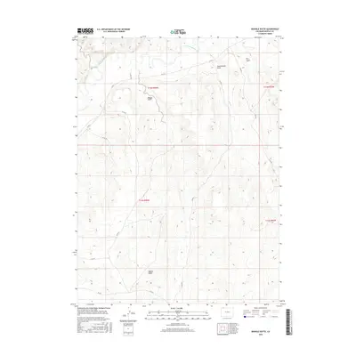
2016 Map of Bighole Butte
USGS Topo · Published 2016About this map
The Little Snake River winds through the northern reaches of this high-desert landscape in Moffat County, creating a distinct riparian corridor against the surrounding arid terrain. Rising prominently in the south, Bighole Butte serves as a local landmark, surrounded by a complex system of drainage features including Bighole Gulch, Scandinavian Gulch, and Dry Gulch. The map illustrates a sparse network of county roads, such as Co Rd 4 and Co Rd 159, which navigate the elevation changes between the river valley and the higher plateaus. This 2016 survey documents the enduring ranching and public land framework of northwestern Colorado, defined by the Public Land Survey System township and range boundaries including t12n r94w and t11n r94w.
Find a feature on this map
17 named features on this map. Tap any name to fly to it.
Don’t see what you’re looking for? This feature index may not catch every label — zoom into the map to look around manually.
Map Details
Editions of this 2016 Bighole Butte Map
This is the sole edition of this map. No revisions or reprints were ever made.
Other maps of this area

1916 · Craig
USGS Topo · 1:125,000

1954 · Vernal
USGS Topo · 1:250,000

1954 · Rawlins
USGS Topo · 1:250,000

1954 · Rock Springs
USGS Topo · 1:250,000

1954 · Craig
USGS Topo · 1:250,000

1957 · Craig
USGS Topo · 1:250,000

1958 · Rawlins
USGS Topo · 1:250,000

1958 · Vernal
USGS Topo · 1:250,000

1958 · Rock Springs
USGS Topo · 1:250,000

1958 · Craig
USGS Topo · 1:250,000