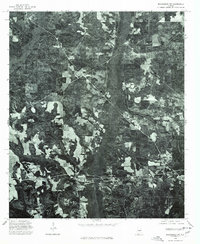
1975 Map of Billingsley SW
USGS Topo · Published 1977About this map
Independence anchors the southern portion of this mid-1970s orthophoto, where the landscape transitions from concentrated agricultural clearings into the dense woodlands of central Alabama. Unlike traditional topographic maps, this aerial perspective reveals the texture of the timber and farming economy of the era, showing the precise footprints of homesteads and the winding local road networks that connect these rural hubs. Further north, the settlement of Vida sits within a mosaic of timber tracts, illustrating the patchwork of land use that characterized this part of the state before modern large-scale development altered the rural layout. The imagery provides a clear view of the drainage patterns and topographical relief that dictate the placement of buildings and fields in this corner of Autauga County.
Find a feature on this map
2 named features on this map. Tap any name to fly to it.
Don’t see what you’re looking for? This feature index may not catch every label — zoom into the map to look around manually.
Map Details
Editions of this 1975 Billingsley SW Map
This is the sole edition of this map. No revisions or reprints were ever made.
Other maps of this area

1891 · Clanton
USGS Topo · 1:125,000

1953 · Montgomery
USGS Topo · 1:250,000

1956 · Montgomery
USGS Topo · 1:250,000

1957 · Montgomery
USGS Topo · 1:250,000

1957 · Autaugaville
USGS Topo · 1:62,500

1957 · Benton
USGS Topo · 1:62,500

1959 · Plantersville
USGS Topo · 1:62,500

1959 · Billingsley
USGS Topo · 1:62,500

1975 · Plantersville SE
USGS Topo · 1:24,000
1975 · Benton NE
USGS Topo · 1:24,000