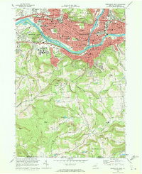
1968 Map of Binghamton West
USGS Topo · Published 1977About this map
The Susquehanna River and Chenango River converge in this detailed mapping of the Triple Cities area during a period of significant mid-century expansion. The urban footprint of Binghamton and Johnson City is densely detailed, showing institutional landmarks like Wilson Hospital, Lourdes Hospital, and the sprawling campus of the State University of New York at Binghamton. The transition from the river-valley industry and the Erie-Lackawanna rail corridor to the surrounding uplands is sharp, marked by landmarks such as Ross Park and the Vestal Hills Golf Club.
Find a feature on this map
112 named features on this map. Tap any name to fly to it.
Don’t see what you’re looking for? This feature index may not catch every label — zoom into the map to look around manually.
Map Details
Editions of this 1968 Binghamton West Map
Other maps of this area

1901 · Apalachin
USGS Topo · 1:62,500

1904 · Binghamton
USGS Topo · 1:62,500

1904 · Apalachin
USGS Topo · 1:62,500

1906 · Catatonk
USGS Topo · 1:125,000

1934 · Castle Creek
USGS Topo · 1:24,000

1935 · Binghamton West
USGS Topo · 1:24,000

1935 · Chenango Forks
USGS Topo · 1:24,000

1937 · Binghamton East
USGS Topo · 1:24,000

1942 · Binghamton West
USGS Topo · 1:31,680

1942 · Castle Creek
USGS Topo · 1:31,680