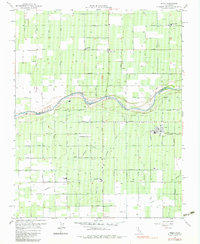
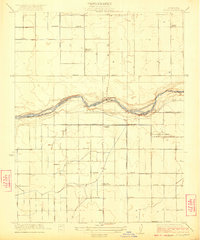
1963 Map of Biola
USGS Topo · Published 1983About this map
The San Joaquin River snakes through this agricultural landscape on the border of Madera and Fresno counties, its course punctuated by Skaggs Bridge and nearby gravel pits. To the north, the community of Ripperdan serves as a small rural hub, while the more developed town of Biola sits to the southeast along the Southern Pacific railroad line. The map reveals an intensive irrigation network essential to the Central Valley's economy, featuring the Herndon Canal, Madera Canal, and the Empire Ditch. Educational and community anchors like Kerman Union High Sch and Bethany Cem are clearly marked, alongside various local schools and Briscoe Field. The grid of avenues, from Avenue 225 down to Olive Ave, illustrates the systematic transformation of the terrain into productive farmland during the early 1960s.
Find a feature on this map
36 named features on this map. Tap any name to fly to it.
Don’t see what you’re looking for? This feature index may not catch every label — zoom into the map to look around manually.
Map Details
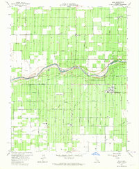
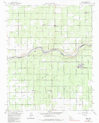
Editions of this 1963 Biola Map
4 editions found

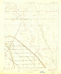
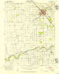
Other maps of this area

1920 · Bonita Ranch
USGS Topo · 1:31,680

1921 · Bonita Ranch
USGS Topo · 1:31,680

1922 · Gregg
USGS Topo · 1:31,680
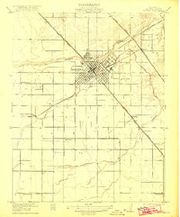
1922 · Madera
USGS Topo · 1:31,680

1923 · Kearney Park
USGS Topo · 1:31,680

1923 · Herndon
USGS Topo · 1:31,680
1923 · Biola
USGS Topo · 1:31,680
1924 · Jamesan
USGS Topo · 1:31,680

1924 · Gravelly Ford
USGS Topo · 1:31,680
1946 · Madera
USGS Topo · 1:62,500