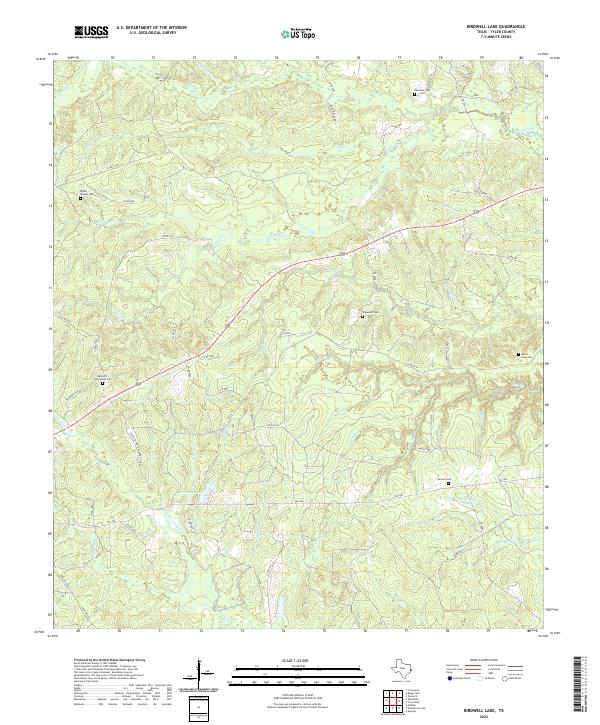
2022 Map of Birdwell Lake
USGS Topo · Published 2022About this map
Small, family-named burial grounds and a dense network of creek branches define this section of Tyler County. The landscape is characterized by its complex drainage, where Wolf Creek and Theuvenins Cr receive numerous tributaries such as Push Cr and Wash Hole Br. For genealogists, the map is particularly rich in cemetery locations, documenting sites like Antioch Cem, the Moss Hill Community Cem, and the Rigsby - Weaver Cem along the secondary roads. The namesake Birdwell Lake sits near the junction of FM 1746 and Co RD 4320, while more remote sites like the Milner - Dean Cem are found along the eastern ridges. This modern survey reflects the enduring rural structure of East Texas, where the local economy and land divisions remain tied to traditional road layouts and the numerous branches feeding the Neches River basin.
Find a feature on this map
68 named features on this map. Tap any name to fly to it.
Don’t see what you’re looking for? This feature index may not catch every label — zoom into the map to look around manually.
Map Details
Editions of this 2022 Birdwell Lake Map
This is the sole edition of this map. No revisions or reprints were ever made.
Other maps of this area

1954 · Beaumont
USGS Topo · 1:250,000

1955 · Woodville
USGS Topo · 1:62,500

1955 · Curtis
USGS Topo · 1:62,500

1957 · Beaumont
USGS Topo · 1:250,000

1958 · Warren
USGS Topo · 1:62,500

1958 · Spurger
USGS Topo · 1:62,500

1984 · Beaumont
USGS Topo · 1:250,000
1984 · Woodville
USGS Topo · 1:24,000
1984 · Boggy Lake
USGS Topo · 1:24,000
1984 · Colmesneil
USGS Topo · 1:24,000