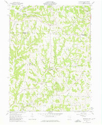
1961 Map of Birmingham
USGS Topo · Published 1976About this map
The Birmingham settlement serves as a central point in this part of the United States Military District, where the borders of Washington, Monroe, and Madison townships converge. The landscape is defined by the winding paths of Clear Fork and Sugartree Fork, which dictate the placement of early rural infrastructure. This 1961 survey illustrates a community anchored by country parishes and small burial grounds, including the Irish Ridge Ch and the Cumberland Cem.
Find a feature on this map
37 named features on this map. Tap any name to fly to it.
Don’t see what you’re looking for? This feature index may not catch every label — zoom into the map to look around manually.
Map Details
Editions of this 1961 Birmingham Map
Other maps of this area

1909 · Antrim
USGS Topo · 1:48,000

1909 · Uhrichsville
USGS Topo · 1:62,500

1909 · Cambridge
USGS Topo · 1:62,500

1911 · Antrim
USGS Topo · 1:62,500

1911 · Uhrichsville
USGS Topo · 1:62,500

1911 · Newcomerstown
USGS Topo · 1:62,500

1912 · Cambridge
USGS Topo · 1:62,500

1913 · Newcomerstown
USGS Topo · 1:62,500

1943 · Newcomerstown
USGS Topo · 1:62,500

1951 · Canton
USGS Topo · 1:250,000