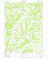
1961 Map of Birmingham
USGS Topo · Published 1978About this map
Birmingham sits at the geographic center of this terrain, where the headwaters of Clear Fork and several unnamed tributaries intersect in the northern reaches of Guernsey County. The landscape is defined by the transition from rural agricultural plots to the expanding Salt Fork Lake in the southwest, surrounded by the protected Salt Fork Wildlife Area. This 1961 survey, updated in the late 1970s, captures a moment when traditional rural infrastructure—evidenced by local landmarks like the Salem-Washington Sch and Irish Ridge Ch—coexisted with emerging resource extraction, including a Strip Mine and Oil Well activity near the Washington and Perry township lines. The dense concentration of family and community burial grounds, such as Cumberland Cem and High Hill Cem, provides a detailed record of the long-standing settlement patterns in the United States Military District.
Find a feature on this map
36 named features on this map. Tap any name to fly to it.
Don’t see what you’re looking for? This feature index may not catch every label — zoom into the map to look around manually.
Map Details
Editions of this 1961 Birmingham Map
Other maps of this area

1909 · Antrim
USGS Topo · 1:48,000

1909 · Uhrichsville
USGS Topo · 1:62,500

1909 · Cambridge
USGS Topo · 1:62,500

1911 · Antrim
USGS Topo · 1:62,500

1911 · Uhrichsville
USGS Topo · 1:62,500

1911 · Newcomerstown
USGS Topo · 1:62,500

1912 · Cambridge
USGS Topo · 1:62,500

1913 · Newcomerstown
USGS Topo · 1:62,500

1943 · Newcomerstown
USGS Topo · 1:62,500

1951 · Canton
USGS Topo · 1:250,000