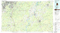
1984 Map of Birmingham South
USGS Topo · Published 1985About this map
Birmingham and its southern suburbs define the industrial and residential core of this 1984 survey, where the ridges of Red Mountain and Shades Mountain channel urban growth into the surrounding valleys. The map documents the extensive expansion of Hoover, Vestavia Hills, and Mountain Brook just before the mid-1980s, set against the older mining and rail centers of Bessemer and Shelby.
Find a feature on this map
214 named features on this map. Tap any name to fly to it.
Don’t see what you’re looking for? This feature index may not catch every label — zoom into the map to look around manually.
Map Details
Editions of this 1984 Birmingham South Map
2 editions found
Other maps of this area

1889 · Springville
USGS Topo · 1:125,000

1889 · Birmingham
USGS Topo · 1:125,000

1890 · Bessemer
USGS Topo · 1:125,000

1890 · Talladega
USGS Topo · 1:125,000

1891 · Clanton
USGS Topo · 1:125,000

1891 · Ashland
USGS Topo · 1:125,000

1892 · Birmingham
USGS Topo · 1:125,000

1892 · Springville
USGS Topo · 1:125,000

1892 · Talladega
USGS Topo · 1:125,000

1892 · Bessemer
USGS Topo · 1:125,000