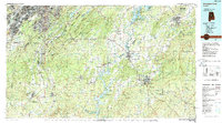
1984 Map of Birmingham South
USGS Topo · Published 1988About this map
The Cahaba River and the Coosa River systems frame a landscape defined by the parallel ridges of Oak Mountain and Talladega Mountain. In the northwest, the industrial and residential core of Birmingham and Bessemer transitions into the suburban expansion around Hoover and Pelham. This mid-1980s topography documents the region's complex infrastructure, where major arteries like I-65 and I-459 intersect with historic rail lines such as the L & N RR and Sou Ry. Large reservoirs including Lay Lake and Logan Martin Lake illustrate the development of water resources along the Coosa. Beyond the urban centers, the presence of the Talladega National Forest and specialized zones like the U S Military Reservation near Childersburg highlight the mix of conservation and federal land use that characterizes the central Alabama corridor between Sylacauga and the Birmingham metropolitan area.
Find a feature on this map
97 named features on this map. Tap any name to fly to it.
Don’t see what you’re looking for? This feature index may not catch every label — zoom into the map to look around manually.
Map Details
Editions of this 1984 Birmingham South Map
2 editions found
Other maps of this area

1889 · Springville
USGS Topo · 1:125,000

1889 · Birmingham
USGS Topo · 1:125,000

1890 · Bessemer
USGS Topo · 1:125,000

1890 · Talladega
USGS Topo · 1:125,000

1891 · Clanton
USGS Topo · 1:125,000

1891 · Ashland
USGS Topo · 1:125,000

1892 · Birmingham
USGS Topo · 1:125,000

1892 · Springville
USGS Topo · 1:125,000

1892 · Talladega
USGS Topo · 1:125,000

1892 · Bessemer
USGS Topo · 1:125,000