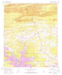
1966 Map of Bismarck
USGS Topo · Published 1977About this map
De Gray Lake dominates the southern landscape of this mid-1960s survey, representing a significant modification of the Caddo River valley. The map documents a period of transition for this part of Hot Spring and Clark counties, where the newly created reservoir intersects with established rural communities. The settlement of Bismarck sits at a crossroads of local activity, supported by numerous nearby spiritual centers such as Bismarck Chapel, Baptist Ch, and Oak Bower Ch. To the west, Lambert remains a focal point for the surrounding farms and woodlands.
Find a feature on this map
30 named features on this map. Tap any name to fly to it.
Don’t see what you’re looking for? This feature index may not catch every label — zoom into the map to look around manually.
Map Details
Editions of this 1966 Bismarck Map
2 editions found
Other maps of this area

1943 · Antoine
USGS Topo · 1:62,500

1955 · Little Rock
USGS Topo · 1:250,000

1956 · Little Rock
USGS Topo · 1:250,000

1959 · Caddo Valley
USGS Topo · 1:24,000

1960 · Little Rock
USGS Topo · 1:250,000

1964 · Little Rock
USGS Topo · 1:250,000

1966 · Pearcy
USGS Topo · 1:24,000

1966 · Hempwallace
USGS Topo · 1:24,000

1966 · De Roche
USGS Topo · 1:24,000
1966 · Point Cedar
USGS Topo · 1:24,000