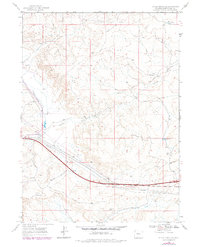
1968 Map of Bitter Creek NW
USGS Topo · Published 1978About this map
High desert drainage patterns and modern industrial infrastructure intersect in this 1968 survey of the Sweetwater County landscape. The terrain is defined by the ephemeral courses of Tenmile Draw and Deadman Wash, which channel seasonal runoff through the arid basin. Water management is evident in the presence of Tenmile Res No 4 and Tenmile Res No 3, small reservoirs that served the region's ranching or industrial needs during the late 1960s.
Find a feature on this map
19 named features on this map. Tap any name to fly to it.
Don’t see what you’re looking for? This feature index may not catch every label — zoom into the map to look around manually.
Map Details
Editions of this 1968 Bitter Creek NW Map
2 editions found
Other maps of this area

1954 · Rock Springs
USGS Topo · 1:250,000

1958 · Rock Springs
USGS Topo · 1:250,000

1958 · Twelvemile Well
USGS Topo · 1:62,500

1958 · Superior
USGS Topo · 1:62,500

1962 · Rock Springs
USGS Topo · 1:250,000

1968 · Bitter Creek NW
USGS Topo · 1:24,000

1968 · Bitter Creek
USGS Topo · 1:24,000

1968 · Black Buttes
USGS Topo · 1:24,000

1968 · Point Of Rocks
USGS Topo · 1:24,000
1968 · Point Of Rocks SE
USGS Topo · 1:24,000