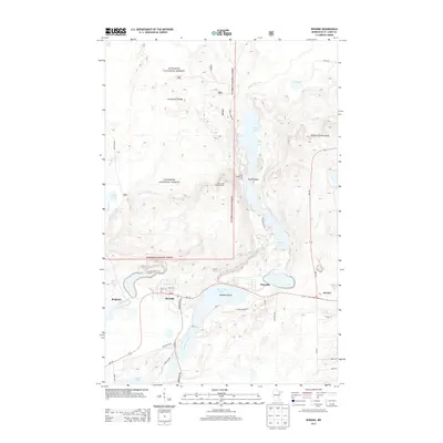
2013 Map of Biwabik
USGS Topo · Published 2013About this map
The Laurentian Divide cuts across this section of the Mesabi Iron Range, where the waters of the Pike River and the Embarrass River flow toward separate drainage basins. This landscape is defined by its series of elongated lakes, including Sabin Lake, Wynne Lake, and Embarrass Lake, which are hemmed in by the Embarrass Mountains to the east. The settlements of Biwabik, Belgrade, Pineville, and a portion of Aurora are situated along the southern corridor of the quadrangle, connected by MN-135 and the historic Vermillion Trl.
Find a feature on this map
41 named features on this map. Tap any name to fly to it.
Don’t see what you’re looking for? This feature index may not catch every label — zoom into the map to look around manually.
Map Details
Editions of this 2013 Biwabik Map
This is the sole edition of this map. No revisions or reprints were ever made.
Other maps of this area

1949 · Aurora
USGS Topo · 1:24,000

1949 · Embarrass
USGS Topo · 1:24,000

1950 · Embarrass
USGS Topo · 1:24,000

1950 · Aurora
USGS Topo · 1:24,000

1950 · Biwabik
USGS Topo · 1:24,000

1950 · Mc Kinley
USGS Topo · 1:24,000

1950 · Biwabik NW
USGS Topo · 1:24,000

1950 · Biwabik NE
USGS Topo · 1:24,000

1951 · Biwabik
USGS Topo · 1:24,000

1951 · Mc Kinley
USGS Topo · 1:24,000