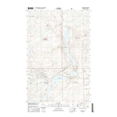
2016 Map of Biwabik
USGS Topo · Published 2016About this map
The Laurentian Divide cuts through this portion of Saint Louis County, marking a significant hydrologic boundary within the Superior National Forest. This landscape is defined by the transition from the Embarrass Mountains down to a chain of major water bodies, including Sabin Lake, Wynne Lake, and Embarrass Lake. The settlements of Biwabik, Aurora, Pineville, and Belgrade are clustered along the southern portion of the map, connected by a network of local roads and the Duluth Missabe and Iron Range RR.
Find a feature on this map
71 named features on this map. Tap any name to fly to it.
Don’t see what you’re looking for? This feature index may not catch every label — zoom into the map to look around manually.
Map Details
Editions of this 2016 Biwabik Map
This is the sole edition of this map. No revisions or reprints were ever made.
Other maps of this area

1949 · Aurora
USGS Topo · 1:24,000

1949 · Embarrass
USGS Topo · 1:24,000

1950 · Embarrass
USGS Topo · 1:24,000

1950 · Aurora
USGS Topo · 1:24,000

1950 · Biwabik
USGS Topo · 1:24,000

1950 · Mc Kinley
USGS Topo · 1:24,000

1950 · Biwabik NW
USGS Topo · 1:24,000

1950 · Biwabik NE
USGS Topo · 1:24,000

1951 · Biwabik
USGS Topo · 1:24,000

1951 · Mc Kinley
USGS Topo · 1:24,000