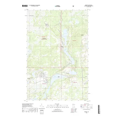
2019 Map of Biwabik
USGS Topo · Published 2019About this map
Superior National Forest encompasses much of this northeastern Minnesota landscape, where the Laurentian Divide separates water systems across the Embarrass Mountains. The area is defined by its glacial hydrology, with Embarrass Lake, Sabin Lake, and Wynne Lake linked by the Embarrass River. Settled communities such as Biwabik, Pineville, and Aurora are clustered in the southern half of the map, revealing a transition from the wooded highlands to the more developed Iron Range corridor. In Biwabik, a specific Depot Location and Lakeside Cem near the river point to the town's historical infrastructure. The map also traces modern recreational and transport networks, including the Laurentian Snowmobile trail and Voyageurs Trl, which navigate the complex terrain of The Narrows and surrounding ridges.
Find a feature on this map
59 named features on this map. Tap any name to fly to it.
Don’t see what you’re looking for? This feature index may not catch every label — zoom into the map to look around manually.
Map Details
Editions of this 2019 Biwabik Map
This is the sole edition of this map. No revisions or reprints were ever made.
Other maps of this area

1949 · Aurora
USGS Topo · 1:24,000

1949 · Embarrass
USGS Topo · 1:24,000

1950 · Embarrass
USGS Topo · 1:24,000

1950 · Aurora
USGS Topo · 1:24,000

1950 · Biwabik
USGS Topo · 1:24,000

1950 · Mc Kinley
USGS Topo · 1:24,000

1950 · Biwabik NW
USGS Topo · 1:24,000

1950 · Biwabik NE
USGS Topo · 1:24,000

1951 · Biwabik
USGS Topo · 1:24,000

1951 · Mc Kinley
USGS Topo · 1:24,000