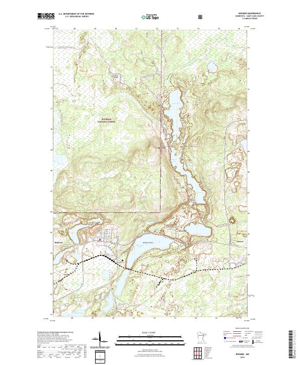
2022 Map of Biwabik
USGS Topo · Published 2022About this map
Biwabik and the iron-rich terrain of the Mesabi Range define this portion of St. Louis County, where the industrial legacy of the Iron Range meets the expansive Superior National Forest. The landscape is physically divided by the Laurentian Divide, a significant continental break that separates the northern and southern watersheds of North America. Water dominates the central corridor, with Sabin Lake, Wynne Lake, and the broad expanse of Embarrass Lake creating a chain of recreation and drainage between the Embarrass Mountains and the surrounding settlements.
Find a feature on this map
54 named features on this map. Tap any name to fly to it.
Don’t see what you’re looking for? This feature index may not catch every label — zoom into the map to look around manually.
Map Details
Editions of this 2022 Biwabik Map
This is the sole edition of this map. No revisions or reprints were ever made.
Other maps of this area

1949 · Aurora
USGS Topo · 1:24,000

1949 · Embarrass
USGS Topo · 1:24,000

1950 · Embarrass
USGS Topo · 1:24,000

1950 · Aurora
USGS Topo · 1:24,000

1950 · Biwabik
USGS Topo · 1:24,000

1950 · Mc Kinley
USGS Topo · 1:24,000

1950 · Biwabik NW
USGS Topo · 1:24,000

1950 · Biwabik NE
USGS Topo · 1:24,000

1951 · Biwabik
USGS Topo · 1:24,000

1951 · Mc Kinley
USGS Topo · 1:24,000