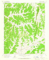
1963 Map of Bixler Ranch
USGS Topo · Published 1966About this map
The Jicarilla Apache Indian Reservation Boundary cuts north-to-south through this Rio Arriba County landscape, dividing high mesas and deeply etched canyons. Small ranching outposts and cabins define the human footprint, from the namesake Bixler Ranch to Lynch Ranch and Vaqueros Cabin near Vaqueros Canyon. The terrain is characterized by the prominent Chicosa Ridge and the striking geological formation known as the Hole-in-the-rock Dike north of Bancos Lake. Evidence of early resource extraction appears via a Gas Well and a Pipeline cutting through the western drainage of Manuel Canyon. Life in this high-elevation backcountry was tied to reliable water sources such as Mud Spring and Preacher Tank, while the presence of a Cem near Cabresto Canyon provides a specific point of interest for genealogists tracing local families in the Carson National Forest.
Find a feature on this map
31 named features on this map. Tap any name to fly to it.
Don’t see what you’re looking for? This feature index may not catch every label — zoom into the map to look around manually.
Map Details
Editions of this 1963 Bixler Ranch Map
3 editions found
Other maps of this area

1889 · Largo
USGS Topo · 1:250,000

1895 · Largo
USGS Topo · 1:250,000

1954 · Aztec
USGS Topo · 1:250,000

1958 · Aztec
USGS Topo · 1:250,000

1962 · Aztec
USGS Topo · 1:250,000
1963 · Espinosa Ranch
USGS Topo · 1:24,000

1963 · Gobernador
USGS Topo · 1:24,000
1963 · Cement Lake
USGS Topo · 1:24,000
1963 · John Mills Lake
USGS Topo · 1:24,000
1963 · Bancos Mesa
USGS Topo · 1:24,000