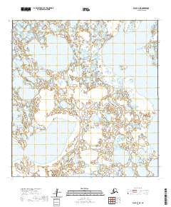
2020 Map of Black A-1 NE
USGS Topo · Published 2020About this map
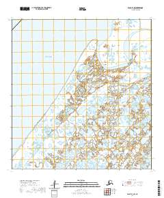
Black River meanders through this portion of the Kusilvak Census Area in western Alaska, defining a landscape of complex hydrology. The map illustrates a dense network of unnamed wetlands, thaw lakes, and sloughs characteristic of the Yukon-Kuskokwim Delta. This terrain is marked by the Public Land Survey System boundaries of t25n r86w, t25n r85w, t24n r87w, and t24n r86w, which provide a geographic framework for an area devoid of permanent road infrastructure or named settlements. For those studying the environmental history of the Alaskan bush, the shifting course of the river and the intricate lake patterns offer a look at the region's natural drainage before significant modern human intervention.
Find a feature on this map
5 named features on this map. Tap any name to fly to it.
Don’t see what you’re looking for? This feature index may not catch every label — zoom into the map to look around manually.
Map Details
Editions of this 2020 Black A-1 NE Map
This is the sole edition of this map. No revisions or reprints were ever made.
Other maps of this area

1951 · Black
USGS Topo · 1:250,000

1952 · Kwiguk
USGS Topo · 1:250,000

1952 · Black A-1
USGS Topo · 1:63,360

1952 · Black B-1
USGS Topo · 1:63,360

1952 · Kwiguk B-6
USGS Topo · 1:63,360

1952 · Kwiguk A-6
USGS Topo · 1:63,360
2020 · Kwiguk A-6 NW
USGS Topo · 1:25,000
2020 · Kwiguk B-6 SW
USGS Topo · 1:25,000
2020 · Kwiguk A-6 SW
USGS Topo · 1:25,000
2020 · Black B-1 SW
USGS Topo · 1:25,000