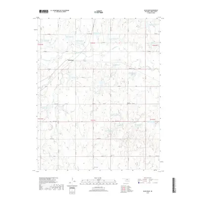
2018 Map of Black Bear
USGS Topo · Published 2018About this map
Black Bear serves as a central point in this rural landscape within Noble County, defined by a complex network of flood control structures and agricultural infrastructure. The terrain is characterized by a series of engineered reservoirs, such as Upper Black Bear Cr Site 13 Reservoir and Upper Black Bear Cr Site 65 Reservoir, which regulate the namesake creek and its many tributaries. This land management pattern is interspersed with sites of deep local heritage, including the Bohemian Catholic Cem, reflecting the early immigrant settlement patterns of the region. Distinctive landmarks like Knob Hill rise above the rolling plains, while a grid of section-line roads like Lariat and Independence connect the dispersed farmsteads and rural cemeteries like Zion Cem.
Find a feature on this map
66 named features on this map. Tap any name to fly to it.
Don’t see what you’re looking for? This feature index may not catch every label — zoom into the map to look around manually.
Map Details
Editions of this 2018 Black Bear Map
This is the sole edition of this map. No revisions or reprints were ever made.
Other maps of this area

1893 · Mulhall
USGS Topo · 1:62,500

1893 · Stillwater
USGS Topo · 1:62,500

1955 · Enid
USGS Topo · 1:250,000

1958 · Enid
USGS Topo · 1:250,000

1966 · Lake Carl Blackwell
USGS Topo · 1:24,000
1967 · Stillwater North
USGS Topo · 1:24,000

1972 · Morrison NE
USGS Topo · 1:24,000

1972 · Morrison
USGS Topo · 1:24,000

1972 · Red Rock
USGS Topo · 1:24,000

1972 · Ceres
USGS Topo · 1:24,000