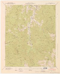
1947 Map of Black Brothers
USGS Topo · Published 1947About this map
Cane River winds through this high-elevation terrain in Yancey Co, where the landscape is defined by the steep ridges of the Pisgah National Forest and Mt Mitchell State Park. The mid-century era is evidenced by the industrial and transport infrastructure serving these isolated communities, including a Toll Road leading toward the peaks and an Aerial Tramway near the park boundary. Settlements like Pensacola and Murchison anchor the valley, while higher elevations feature remote outposts such as Camp Alice. Family history is deeply rooted in the landscape through numerous burial grounds like Burleson Cem and Ray Cem. Physical landmarks such as Point Misery and Big Butt provide a sense of the formidable geography encountered by residents of Vixen (PO) and Eskota during this period of development.
Find a feature on this map
114 named features on this map. Tap any name to fly to it.
Don’t see what you’re looking for? This feature index may not catch every label — zoom into the map to look around manually.
Map Details
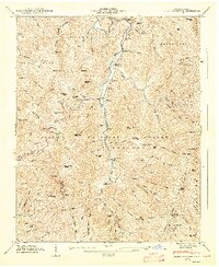
Editions of this 1947 Black Brothers Map
2 editions found
Other maps of this area

1900 · Mount Mitchell
USGS Topo · 1:125,000

1902 · Mount Mitchell
USGS Topo · 1:125,000

1934 · Micaville
USGS Topo · 1:24,000

1934 · Parts Of Celo And Black Brothers
USGS Topo · 1:24,000

1934 · Parts Of Old Fort and Montreat
USGS Topo · 1:24,000

1935 · Montreat
USGS Topo · 1:24,000

1935 · Black Brothers
USGS Topo · 1:24,000

1935 · Burnsville
USGS Topo · 1:24,000

1935 · Bald Creek
USGS Topo · 1:24,000

1935 · Barnardsville
USGS Topo · 1:24,000