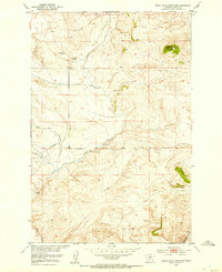
1951 Map of Black Butte Mountain
USGS Topo · Published 1953About this map
Black Butte Mountain dominates the northeast corner of this 1950s survey, a prominent landmark in the high ranching country of Meagher County. The landscape is defined by the headwaters of numerous waterways, with Battle Creek and Sixteenmile Creek cutting through the terrain. Evidence of early resource extraction and agriculture is documented through the Copper Mine (Inactive) and established family operations such as the J Stewart Ranch and Prescott Ranch. Transportation through the area follows the path of Sixteenmile Road, reflecting the rural infrastructure during the post-war development of the Missouri River Basin. This mapping effort by the Geological Survey and Bureau of Reclamation provides a precise record of drainage patterns and land use, from Faulkner Creek to the winding course of Mike Day Creek.
Find a feature on this map
11 named features on this map. Tap any name to fly to it.
Don’t see what you’re looking for? This feature index may not catch every label — zoom into the map to look around manually.
Map Details
Editions of this 1951 Black Butte Mountain Map
3 editions found
Other maps of this area

1886 · Fort Logan
USGS Topo · 1:250,000

1886 · Little Belt Mts.
USGS Topo · 1:250,000

1894 · Little Belt Mts.
USGS Topo · 1:250,000

1897 · Little Belt Mts.
USGS Topo · 1:250,000

1898 · Little Belt Mts.
USGS Topo · 1:250,000

1902 · Little Belt Mts.
USGS Topo · 1:250,000

1948 · White Sulphur Springs
USGS Topo · 1:250,000

1948 · Sixteen
USGS Topo · 1:24,000

1949 · Maudlow
USGS Topo · 1:62,500

1951 · Sixteen NE
USGS Topo · 1:24,000