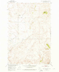
1951 Map of Black Butte Mountain
USGS Topo · Published 1976About this map
Black Butte Mountain dominates this mid-century landscape in Meagher County, rising as a prominent landmark above a network of high-country drainage systems. The survey reflects a sparsely settled ranching and resource territory during the post-war era, anchored by family operations like the J Stewart Ranch and Prescott Ranch. A single Copper Mine located in the northwest quadrant indicates the legacy of earlier mineral exploration in these highlands. The terrain is defined by the complex confluence of Sixteenmile Creek and its tributaries, including Battle Creek, Mike Day Creek, and Faulkner Creek. These watercourses carve through the topography, dictating the placement of the few improved and unimproved roads that serve the isolated ranchsteads and mining claims of this central Montana region.
Find a feature on this map
10 named features on this map. Tap any name to fly to it.
Don’t see what you’re looking for? This feature index may not catch every label — zoom into the map to look around manually.
Map Details
Editions of this 1951 Black Butte Mountain Map
3 editions found
Other maps of this area

1886 · Fort Logan
USGS Topo · 1:250,000

1886 · Little Belt Mts.
USGS Topo · 1:250,000

1894 · Little Belt Mts.
USGS Topo · 1:250,000

1897 · Little Belt Mts.
USGS Topo · 1:250,000

1898 · Little Belt Mts.
USGS Topo · 1:250,000

1902 · Little Belt Mts.
USGS Topo · 1:250,000

1948 · White Sulphur Springs
USGS Topo · 1:250,000

1948 · Sixteen
USGS Topo · 1:24,000

1949 · Maudlow
USGS Topo · 1:62,500

1951 · Sixteen NE
USGS Topo · 1:24,000