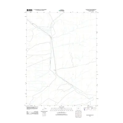
2012 Map of Black Buttes
USGS Topo · Published 2012About this map
Bitter Cr carves a winding path through this corner of Sweetwater County, providing a central drainage for the arid landscape south of Interstate 80. The settlement of Black Buttes sits at the junction of Co Rd 84 and Black Buttes Rd, marking a point of transition where local thoroughfares meet the expansive desert terrain. To the northwest, the map identifies Hallville, another small node of activity positioned along the creek. The topography is defined by the subtle drainage patterns of intermittent streams that feed into the main channel, illustrating the critical role of water courses in determining the placement of early ranching and transport infrastructure in the high desert of Wyoming.
Find a feature on this map
5 named features on this map. Tap any name to fly to it.
Don’t see what you’re looking for? This feature index may not catch every label — zoom into the map to look around manually.
Map Details
Editions of this 2012 Black Buttes Map
This is the sole edition of this map. No revisions or reprints were ever made.
Other maps of this area

1954 · Rock Springs
USGS Topo · 1:250,000

1958 · Rock Springs
USGS Topo · 1:250,000

1962 · Rock Springs
USGS Topo · 1:250,000

1968 · Cooper Ridge NE
USGS Topo · 1:24,000

1968 · Bitter Creek NW
USGS Topo · 1:24,000

1968 · Sand Butte Rim NW
USGS Topo · 1:24,000

1968 · Bitter Creek
USGS Topo · 1:24,000

1968 · Black Buttes
USGS Topo · 1:24,000

1968 · Point Of Rocks
USGS Topo · 1:24,000
1968 · Point Of Rocks SE
USGS Topo · 1:24,000