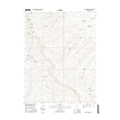
2016 Map of Black Cabin Gulch
USGS Topo · Published 2016About this map
Cathedral Bluffs dominate this portion of Rio Blanco County, where high ridges and deep canyons define a landscape carved by intricate drainage networks. This 2016 survey illustrates a topography of named landmarks like Airplane Ridge and Wagonroad Ridge, which separate the myriad of draws and gulches flowing through the territory. The region is characterized by significant natural features such as Black Cabin Gulch and Horse Pasture Canyon, while water systems like Cathedral Cr and Willow Creek navigate the lower elevations. The map provides a look at the road system including Co RD 103 and Co RD 28, showing how these routes follow the contours of the land to connect the high points, such as Black Cabin Point, with the deeper valleys of Tommys Draw and Spruce Gulch.
Find a feature on this map
41 named features on this map. Tap any name to fly to it.
Don’t see what you’re looking for? This feature index may not catch every label — zoom into the map to look around manually.
Map Details
Editions of this 2016 Black Cabin Gulch Map
This is the sole edition of this map. No revisions or reprints were ever made.
Other maps of this area

1929 · Highmore
USGS Topo · 1:62,500

1952 · Wolf Ridge
USGS Topo · 1:24,000

1952 · Yankee Gulch
USGS Topo · 1:24,000

1956 · Grand Junction
USGS Topo · 1:250,000

1959 · Grand Junction
USGS Topo · 1:250,000

1960 · Grand Junction
USGS Topo · 1:250,000

1962 · Grand Junction
USGS Topo · 1:250,000

1964 · Grand Junction
USGS Topo · 1:250,000

1964 · Brushy Point
USGS Topo · 1:24,000
1964 · Philadelphia Creek
USGS Topo · 1:24,000