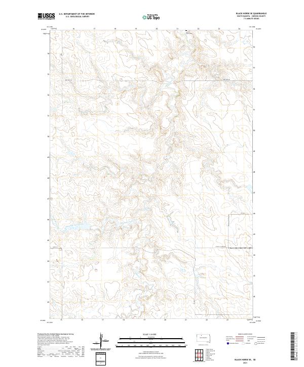
2021 Map of Black Horse SE
USGS Topo · Published 2021About this map
Holy Spirit Cem sits on the northern edge of this section of Corson County, overlooking a landscape defined by the winding paths of Firesteel Cr and Standing Cloud Cr. The terrain is marked by the complex drainage patterns of these creeks as they carve through the South Dakota plains. Transportation across these rural townships is managed by a network of gravel and section-line roads, including Firesteel Rd and Co Rd 21 Firesteel, which follow the natural contours of the land and the established Public Land Survey System boundaries of t19n r23e and t18n r23e. This 2021 update by the U.S. Geological Survey provides a precise view of the remote drainage systems and the few established landmarks that anchor this expansive landscape.
Find a feature on this map
11 named features on this map. Tap any name to fly to it.
Don’t see what you’re looking for? This feature index may not catch every label — zoom into the map to look around manually.
Map Details
Editions of this 2021 Black Horse SE Map
This is the sole edition of this map. No revisions or reprints were ever made.
Other maps of this area

1953 · McIntosh
USGS Topo · 1:250,000

1956 · Miscol SW
USGS Topo · 1:24,000

1956 · Black Horse NE
USGS Topo · 1:24,000

1956 · Black Horse SW
USGS Topo · 1:24,000

1956 · Black Horse SE
USGS Topo · 1:24,000

1956 · Black Horse
USGS Topo · 1:24,000

1956 · Miscol
USGS Topo · 1:24,000

1958 · McIntosh
USGS Topo · 1:250,000

1978 · Brewer Butte
USGS Topo · 1:24,000

1978 · Isabel
USGS Topo · 1:24,000