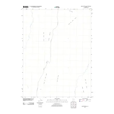
2011 Map of Black Knolls
USGS Topo · Published 2011About this map
Black Knolls anchors this 2011 survey of a remote and arid drainage basin in Uintah County, where the topography is defined by a series of north-to-south ridges and deeply cut canyons. The primary corridor through this landscape is the Sego Canyon Rd, which traverses the terrain alongside several major gulches. Local water sources are sparse but critical, represented here by Goat Spring and seasonal drainages like Hill Creek and Willow Creek. The map documents a complex network of physical features, from the prominence of Steer Ridge and Picket Corral Ridge to the narrow confines of Upper Wagon Canyon and Billie Brown Canyon. This layout provides an intricate view of the canyon-and-plateau geography prior to modern infrastructure development in this part of eastern Utah.
Find a feature on this map
12 named features on this map. Tap any name to fly to it.
Don’t see what you’re looking for? This feature index may not catch every label — zoom into the map to look around manually.
Map Details
Editions of this 2011 Black Knolls Map
This is the sole edition of this map. No revisions or reprints were ever made.
Other maps of this area

1885 · East Tavaputs
USGS Topo · 1:250,000

1953 · Firewater Canyon
USGS Topo · 1:62,500

1956 · Grand Junction
USGS Topo · 1:250,000

1959 · Grand Junction
USGS Topo · 1:250,000

1960 · Grand Junction
USGS Topo · 1:250,000

1962 · Grand Junction
USGS Topo · 1:250,000

1963 · Tenmile Canyon
USGS Topo · 1:62,500

1963 · Moonwater Point
USGS Topo · 1:62,500

1964 · Grand Junction
USGS Topo · 1:250,000

1965 · Grand Junction
USGS Topo · 1:250,000