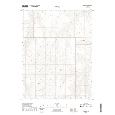
2020 Map of Black Knolls
USGS Topo · Published 2020About this map
Hill Cr winds through this high desert terrain along the border of Uintah County and Grand County, carving through a landscape defined by deep canyons and prominent ridgelines. The western portion of the map is dominated by the narrow drainage of Upper Wagon Canyon, while to the east, the elevation climbs toward the long spine of Steer Ridge. This 2020 survey illustrates the remote topography of the Uintah Basin, where geographic features are often named for early livestock operations and topographic landmarks, such as Picket Corral Ridge and the steep descents of Mail Canyon and Billie Brown Canyon. The absence of developed towns or highways underscores the primitive character of this part of eastern Utah, where the only transit routes are improved roads following the natural contours of the ridges and creek beds.
Find a feature on this map
7 named features on this map. Tap any name to fly to it.
Don’t see what you’re looking for? This feature index may not catch every label — zoom into the map to look around manually.
Map Details
Editions of this 2020 Black Knolls Map
This is the sole edition of this map. No revisions or reprints were ever made.
Other maps of this area

1885 · East Tavaputs
USGS Topo · 1:250,000

1953 · Firewater Canyon
USGS Topo · 1:62,500

1956 · Grand Junction
USGS Topo · 1:250,000

1959 · Grand Junction
USGS Topo · 1:250,000

1960 · Grand Junction
USGS Topo · 1:250,000

1962 · Grand Junction
USGS Topo · 1:250,000

1963 · Tenmile Canyon
USGS Topo · 1:62,500

1963 · Moonwater Point
USGS Topo · 1:62,500

1964 · Grand Junction
USGS Topo · 1:250,000

1965 · Grand Junction
USGS Topo · 1:250,000