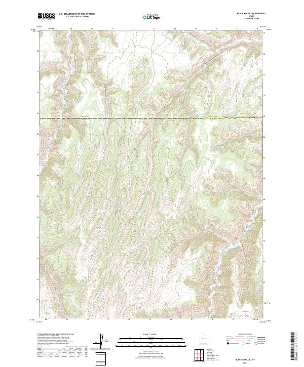
2023 Map of Black Knolls
USGS Topo · Published 2023About this map
Black Knolls anchors a landscape defined by deep canyon systems and high ridges at the border of Uintah and Grand Counties. The map reveals a complex network of seasonal drainage and rugged geography, notably where Hill Creek and Willow Creek carve through the plateau. Water remains a critical point of focus for this high-desert environment, evidenced by isolated features like Goat Spring located near the head of Corral Creek.
Find a feature on this map
14 named features on this map. Tap any name to fly to it.
Don’t see what you’re looking for? This feature index may not catch every label — zoom into the map to look around manually.
Map Details
Editions of this 2023 Black Knolls Map
This is the sole edition of this map. No revisions or reprints were ever made.
Other maps of this area

1885 · East Tavaputs
USGS Topo · 1:250,000

1953 · Firewater Canyon
USGS Topo · 1:62,500

1956 · Grand Junction
USGS Topo · 1:250,000

1959 · Grand Junction
USGS Topo · 1:250,000

1960 · Grand Junction
USGS Topo · 1:250,000

1962 · Grand Junction
USGS Topo · 1:250,000

1963 · Tenmile Canyon
USGS Topo · 1:62,500

1963 · Moonwater Point
USGS Topo · 1:62,500

1964 · Grand Junction
USGS Topo · 1:250,000

1965 · Grand Junction
USGS Topo · 1:250,000