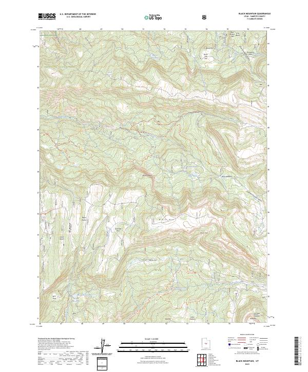
2023 Map of Black Mountain
USGS Topo · Published 2023About this map
Black Mtn stands as the central high point of this section of the Wasatch Plateau, where the complex drainage systems of Sixmile Creek and Twelvemile Creek have carved deep canyons into the landscape. Managed within the Manti-La Sal National Forest, the area serves as a critical watershed, evidenced by the presence of the Patton Reservoir, Newfield Reservoir, and Town Reservoir. These water sources, along with springs like Metcalf Spring and Log Spring, support high-elevation agricultural activities at the Upper Ranch and Lower Ranch. The map reveals a network of recreational and access routes, including the Harmon Atv Trl and Pinchot Trl, which navigate between prominent landmarks such as Loveridge Flat and Julius Pasture. The terrain is characterized by dramatic shifts in elevation, from the White Ledges to the deep depression known as the Black Hole, illustrating the geological diversity of the Sanpete County highlands.
Find a feature on this map
50 named features on this map. Tap any name to fly to it.
Don’t see what you’re looking for? This feature index may not catch every label — zoom into the map to look around manually.
Map Details
Editions of this 2023 Black Mountain Map
This is the sole edition of this map. No revisions or reprints were ever made.
Other maps of this area

1885 · Manti
USGS Topo · 1:250,000

1895 · Manti
USGS Topo · 1:250,000

1922 · Wasatch
USGS Topo · 1:31,680

1956 · Price
USGS Topo · 1:250,000

1960 · Price
USGS Topo · 1:250,000

1962 · Price
USGS Topo · 1:250,000
1965 · Woods Lake
USGS Topo · 1:24,000
1965 · Mayfield
USGS Topo · 1:24,000

1965 · Manti
USGS Topo · 1:24,000

1965 · Black Mountain
USGS Topo · 1:24,000