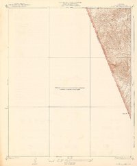
1938 Map of Black Mountain
USGS Topo · Published 1938About this map
Los Padres National Forest dominates this 1932 topographic survey of the mountainous region along the border of Los Angeles and Ventura counties. The terrain is defined by dramatic elevation changes, captured through detailed contour work by C.W.H. Nessier, culminating in the prominent peak of Dome Mtn. Drainage patterns are clearly visible through the descent of Piru Creek and the branching path of Beartrap Canyon, offering a precise record of the watershed before mid-century changes.
Find a feature on this map
7 named features on this map. Tap any name to fly to it.
Don’t see what you’re looking for? This feature index may not catch every label — zoom into the map to look around manually.
Map Details
Editions of this 1938 Black Mountain Map
3 editions found
Other maps of this area

1903 · Tejon
USGS Topo · 1:125,000

1931 · Whitaker Peak
USGS Topo · 1:24,000

1932 · Beartrap Canyon
USGS Topo · 1:24,000

1933 · Quail
USGS Topo · 1:24,000

1933 · Gorman
USGS Topo · 1:24,000

1935 · Whitaker Peak
USGS Topo · 1:24,000

1938 · Beartrap Canyon
USGS Topo · 1:24,000

1938 · Gorman
USGS Topo · 1:24,000

1938 · Black Mountain
USGS Topo · 1:24,000

1938 · Quail
USGS Topo · 1:24,000