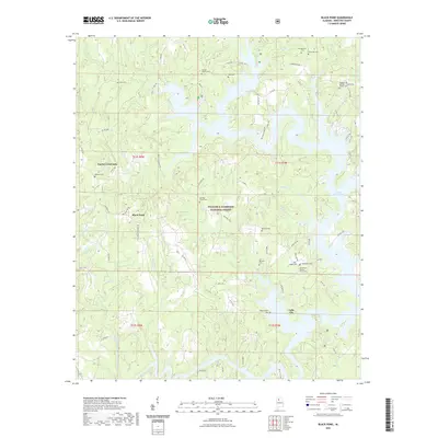
2021 Map of Black Pond
USGS Topo · Published 2021About this map
Lewis Smith Lake dominates the eastern landscape of this Winston County region, where intricate fingers of water reach into the dense woodlands of the William B. Bankhead National Forest. This modern survey reveals a community defined by its proximity to both the reservoir and the forest, with small settlements like Falls City and Black Pond situated near the headwaters of numerous creeks. The topography is exceptionally complex, carved by the Caney Cr system, including its East and West forks, as well as Little Bear Br and Big Bear Br. For local historians and genealogists, the map is remarkably dense with family and community markers, showing over a dozen cemeteries such as Avery Cem, Lane Cem, and McClinton Cem. The presence of Hickory Grove Mine Rd near Black Pond hints at the area's resource-based history within the Cumberland Plateau.
Find a feature on this map
84 named features on this map. Tap any name to fly to it.
Don’t see what you’re looking for? This feature index may not catch every label — zoom into the map to look around manually.
Map Details
Editions of this 2021 Black Pond Map
This is the sole edition of this map. No revisions or reprints were ever made.
Other maps of this area

1893 · Jasper
USGS Topo · 1:125,000

1949 · Manchester
USGS Topo · 1:24,000

1949 · Nauvoo
USGS Topo · 1:24,000

1949 · Sunlight
USGS Topo · 1:24,000

1950 · Nauvoo
USGS Topo · 1:24,000

1950 · Manchester
USGS Topo · 1:24,000
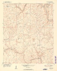
1951 · Sunlight
USGS Topo · 1:24,000

1953 · Birmingham
USGS Topo · 1:250,000

1956 · Birmingham
USGS Topo · 1:250,000

1956 · Gadsden
USGS Topo · 1:250,000