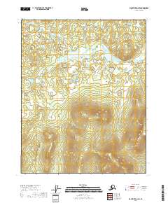
2018 Map of Black River A-2 SW
USGS Topo · Published 2018About this map
Vunvekottlui Lake sits as a primary hydrologic feature within this portion of the Yukon-Koyukuk region, surrounded by a complex system of drainage and relief. The northern reaches are characterized by the meandering path of Dempsey Cr, which cuts through the township boundaries of T15N R27E and T15N R28E. This 2018 survey reveals a landscape largely shaped by its watercourses and elevation changes, typical of the interior Alaskan wilderness. The map provides a detailed view of the topographical transition from the low-lying basin around the lake to the more defined ridgelines in the southern townships of T14N R27E and T14N R28E, offering researchers a clear look at the natural drainage patterns of this sub-arctic environment.
Find a feature on this map
6 named features on this map. Tap any name to fly to it.
Don’t see what you’re looking for? This feature index may not catch every label — zoom into the map to look around manually.
Map Details
Editions of this 2018 Black River A-2 SW Map
This is the sole edition of this map. No revisions or reprints were ever made.
Other maps of this area

1951 · Charley River
USGS Topo · 1:250,000

1951 · Black River
USGS Topo · 1:250,000

1956 · Black River A-2
USGS Topo · 1:63,360

1956 · Black River A-3
USGS Topo · 1:63,360

1956 · Charley River D-3
USGS Topo · 1:63,360

1956 · Black River
USGS Topo · 1:250,000

1956 · Charley River D-2
USGS Topo · 1:63,360

1956 · Charley River
USGS Topo · 1:250,000

1964 · Black River
USGS Topo · 1:250,000
2018 · Black River A-3 SE
USGS Topo · 1:25,000