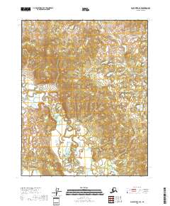
2018 Map of Black River A-3 SE
USGS Topo · Published 2018About this map
The Draanjik River flows through this interior landscape, defining a complex network of wetlands and seasonal watercourses in the Yukon-Koyukuk region. In this late second-decade survey, the river's meandering path across the quadrangle highlights the dynamic hydrology of the Alaskan bush. Smaller tributaries like Dempsey Creek and Owl Cr feed into the broader drainage system, illustrating the natural water-driven corridors that have historically influenced movement and subsistence in this part of the state. The map details the legal boundaries of t15n r26e, t15n r27e, t14n r26e, and t14n r27e, providing the precise land survey framework used for resource management and navigation in a region defined by its hydrographic features.
Find a feature on this map
7 named features on this map. Tap any name to fly to it.
Don’t see what you’re looking for? This feature index may not catch every label — zoom into the map to look around manually.
Map Details
Editions of this 2018 Black River A-3 SE Map
This is the sole edition of this map. No revisions or reprints were ever made.
Other maps of this area

1951 · Charley River
USGS Topo · 1:250,000

1951 · Black River
USGS Topo · 1:250,000

1956 · Black River A-2
USGS Topo · 1:63,360

1956 · Black River A-3
USGS Topo · 1:63,360

1956 · Charley River D-3
USGS Topo · 1:63,360

1956 · Black River
USGS Topo · 1:250,000

1956 · Charley River D-2
USGS Topo · 1:63,360

1956 · Charley River
USGS Topo · 1:250,000

1964 · Black River
USGS Topo · 1:250,000
2018 · Black River A-2 SW
USGS Topo · 1:25,000