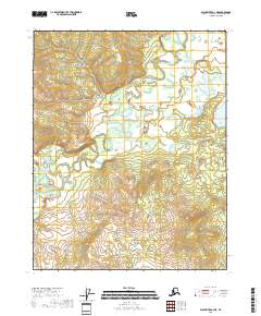
2018 Map of Black River A-3 NE
USGS Topo · Published 2018About this map
Grayling Fork Black River dominates this portion of the interior, meandering through the terrain as part of a complex watershed that includes Dempsey Cr and Ogel Cr. This 2018 survey reveals a landscape largely defined by its natural drainage patterns and topographical contours rather than human-made infrastructure. The lack of roads or established settlements on the sheet underscores the remote nature of the Yukon-Koyukuk Census Area, where the land remains shaped primarily by the movement of these water systems. The map provides a precise record of these hydrologic features, essential for understanding the seasonal changes and environmental character of this section of the Alaskan wilderness.
Find a feature on this map
7 named features on this map. Tap any name to fly to it.
Don’t see what you’re looking for? This feature index may not catch every label — zoom into the map to look around manually.
Map Details
Editions of this 2018 Black River A-3 NE Map
This is the sole edition of this map. No revisions or reprints were ever made.
Other maps of this area

1951 · Black River
USGS Topo · 1:250,000

1956 · Black River A-2
USGS Topo · 1:63,360

1956 · Black River B-3
USGS Topo · 1:63,360

1956 · Black River B-2
USGS Topo · 1:63,360

1956 · Black River A-3
USGS Topo · 1:63,360

1956 · Black River
USGS Topo · 1:250,000

1964 · Black River
USGS Topo · 1:250,000
2018 · Black River A-3 SE
USGS Topo · 1:25,000
2018 · Black River B-3 SW
USGS Topo · 1:25,000
2018 · Black River A-2 SW
USGS Topo · 1:25,000