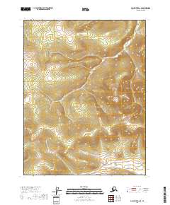
2018 Map of Black River D-2 NE
USGS Topo · Published 2018About this map
The Bureau of Land Management survey lines for T25n R27e and T25n R28e delineate this high-latitude terrain within the Yukon-Koyukuk Census Area. This 2018 study emphasizes the topographic structure of the Alaskan interior, where the Public Land Survey System (PLSS) grid is the primary human overlay on a landscape largely devoid of named settlements or infrastructure. The contour intervals illustrate a complex network of ridgelines and drainages spanning from T24n R28e to T24n R29e, providing a technical look at the region's hydrography as recorded between 2001 and 2015. For researchers or land managers, the map provides a precise record of section boundaries and elevation changes in a remote part of the Black River region.
Find a feature on this map
4 named features on this map. Tap any name to fly to it.
Don’t see what you’re looking for? This feature index may not catch every label — zoom into the map to look around manually.
Map Details
Editions of this 2018 Black River D-2 NE Map
This is the sole edition of this map. No revisions or reprints were ever made.
Other maps of this area

1951 · Black River
USGS Topo · 1:250,000

1951 · Coleen
USGS Topo · 1:250,000

1956 · Coleen
USGS Topo · 1:250,000

1956 · Coleen A-1
USGS Topo · 1:63,360

1956 · Black River D-2
USGS Topo · 1:63,360
1956 · Black River D-1
USGS Topo · 1:63,360

1956 · Coleen A-2
USGS Topo · 1:63,360

1956 · Black River
USGS Topo · 1:250,000

1964 · Black River
USGS Topo · 1:250,000
2018 · Coleen A-2 SE
USGS Topo · 1:25,000