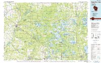
1985 Map of Black River Falls
USGS Topo · Published 1985About this map
Black River Falls serves as the focal point for this mid-1980s landscape, where the Black River carves through a region defined by massive conservation tracts and military acreage. The map details the vast reach of the Black River State Forest and the Fort Mc Coy Military Reservation, illustrating a transition from the agricultural lands near Melrose and Tomah into the wetlands of the Meadow Valley State Wildlife Area. This era shows the heavy presence of rail infrastructure, including the Chicago and North Western and the Chicago Milwaukee St Paul and Pacific lines, which historically served the region's timber and cranberry industries.
Find a feature on this map
157 named features on this map. Tap any name to fly to it.
Don’t see what you’re looking for? This feature index may not catch every label — zoom into the map to look around manually.
Map Details
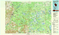
Editions of this 1985 Black River Falls Map
2 editions found
Other maps of this area

1909 · Sparta
USGS Topo · 1:62,500

1916 · Tomah
USGS Topo · 1:62,500

1919 · Kendall
USGS Topo · 1:62,500

1921 · Mauston
USGS Topo · 1:62,500

1921 · Kendall
USGS Topo · 1:62,500

1924 · Black River Falls
USGS Topo · 1:62,500

1926 · Black River Falls
USGS Topo · 1:62,500

1926 · North Bend
USGS Topo · 1:62,500

1927 · Blair
USGS Topo · 1:62,500

1927 · La Crosse
USGS Topo · 1:62,500